Suggested Hikes
Find your new favorite trail!
With such a dense network of trails at your fingertips, it's hard to know where to go hiking on the Copper Harbor Trails. That's why we've made this handy guide for you to plan a hike (or two!) on our mixed-use trails. These trails are open for hiking, trail running, and mountain biking, so expect to see a lot of each while out and about. Please follow proper Trail Etiquette when out on the trails. Together we can all have a great time! Remember to check our Trail Status page before you head out in case there are any closures you should be aware of.
Easy Options
BACK 9 TRAILS
The Back 9 Trails loop around what would have been the second half of the KML golf course, had it been built many decades ago. Today the forest has regrown with a patchwork forest, although you can still find towering white pines along what would have been the lengthy fairways. Three loops twist and turn through this area: Chipmunk Run, Moose on the Loose, and Little Loon. All are wide corridors with plenty of space for both mountain bikers and hikers to pass each other with ease. The terrain is gently rolling and any steep sections were graded out to make it easier for people of all ages and abilities.
Fort Wilkins Gardens
 Not to be confused with the State Park! Located just behind our main trailhead in 'downtown' Copper Harbor, the Fort Wilkins Garden trails are flat, hiking-only trails that wind around scenic ponds and meadows. Enjoy big views of Brockway Mountain above town while hiking beneath shady apple trees that are loaded with fruit every fall. Expect to see community members out in the shared garden space, plenty of birds and other wildlife, and the occasional horse. There are about a mile of trails here to explore. The southern end of this mini-network connects to Stairway to Heaven. Be aware that this area is privately owned.
Intermediate Options
BROCKWAY MOUNTAIN BOTTOM to Top: Berry Picker & The Flow
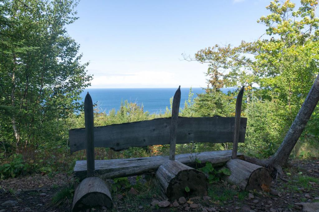 Berry Picker is a new (as of 2024) hiking and climbing biking trail that is designed with hikers in mind! It climbs Brockway Mountain gradually and avoids the tightest, fastest parts of The Flow, eliminating the chances of being startled by downhill bike traffic. A spur leads you to the "Nose of Brockway" overlook above Copper Harbor for impeccable views over the landscape. Start your hike near the pull-off on M-26 and make your way up the hill. Berry patches abound in the late-summer months, as well as huge views out over the lake in all seasons. Eventually Berry Picker intersects with The Flow, after which sight lines are better. There is a picnic table and viewpoint not far past the epic Overflow gap jump near the top of the trail if you are looking for a top-notch lunch spot.
Keweenaw Point Trail (Phase 1: Manganese to Mandan Rd)
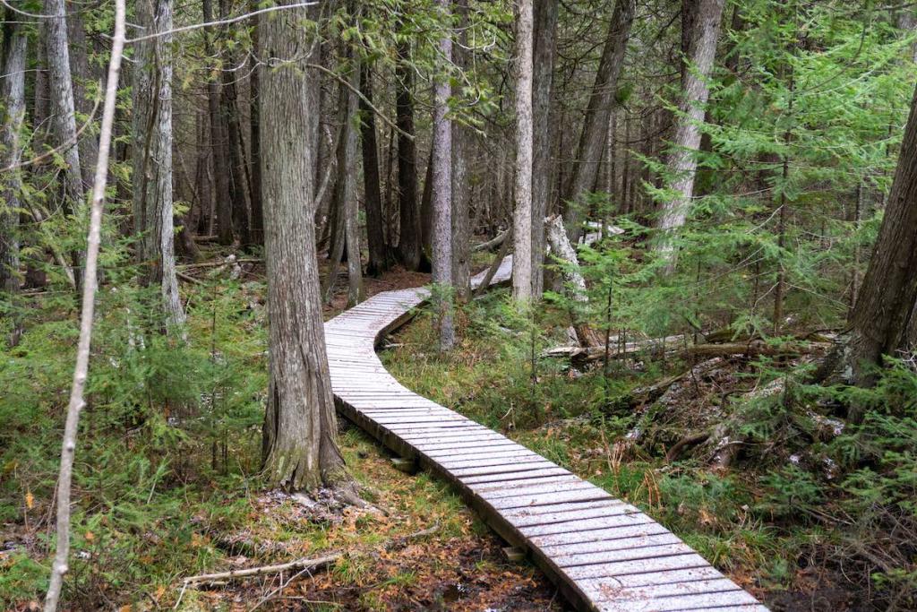 This 2.6-mile segment of the Keweenaw Point Trail is the most accessible as far as location goes. The trail begins just south of Copper Harbor near Manganese Falls, itself a popular but short hiking location. The Point Trail head east, quickly passing Paul's Plunge, and contininuing along a beautiful ridge overlooking Lake Fanny Hooe. Be on the lookout for a glimpse of Fort Wilkins through the forest. The trail itself is fairly rugged as it traverses conglomerate ridges along the side of the slope. Nearer the eastern end, the trail drops quickly before crossing Vulcan Creek with a wide bridge. Eventually the trail reaches its signature feature: a quarter-mile boardwalk through a dense cedar swamp. The boardwalk feels like it goes on forever and is an unparalleled oppoortunity to check out this otherwise tough-to-visit area. The trail ends at Mandan Road. If you want to make this a loop, it is 3.25 miles back to your starting point via the road. Bike traffic can be steadier on busy weekends and is only a problem on the boardwalk portion where passing is more difficult.
Bullwinkle - Woopidy Woo - Garden Brook Loop
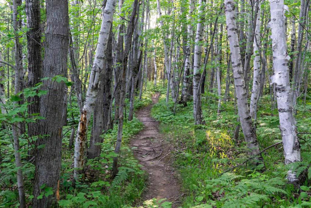
This 2.25-mile loop is a great tour for those looking to get out in a relatively quiet corner of our mixed-use trail system. Parking is accessible just across from the golf course on US-41 near the upper end of the trail Garden Brook. This looped hike is enjoyable in either direction. At the top of the hill near your vehicle the forest is more deciduous, with mixed maples and oaks dominating. Nearer to the Garden Brook valley, tall white pines, dense cedars, and other plants that enjoy wetter soils take over. The upper portions of the trail Garden Brook pass by a waterfall that cascades over the trail, so step lightly to avoid getting your feet wet. Other crossings have boardwalks or short bridges. The trails in this area are somewhat bumpy and you should expect roots and rocks, but nothing too scary. Hills are gradual and bike traffic is fairly low even during busy weekends.
Difficult Options
Red Trail
 Would you believe this is the oldest trail in our system? Red Trail was used in the 1930s by workers constructing the Lodge and golf course and became one of the first hiking trails in the region not long after. Eventually it was absorbed into the Copper Harbor Trails system and is now open to both hikers and mountain bikers. It's a burly trail and is very difficult even for those on foot! Chunky rocks, narrow bridges, and steep rock drops make finding your way a fun challenge. You're rewarded with beautiful views of the surrounding forest and secret lookouts onto Lake Manganese near the southern end. Bike traffic almost entirely comes from up the hill, so there is little need to watch your back if you hike up from Lake Manganese.
Keweenaw Point Trail (Phase II - Mandan Rd to High Rock Bay)
 The Keweenaw Point Trail longest uninterrupted stretch is 5.6 miles of backwoods bliss. Though the trail itself is not particularly difficult for hikers, its distance is what earns it a spot in our most difficult category. A round-trip hike here would be 11 miles, a daunting effort for most people and certainly an all-day excursion if you plan to set out on this journey. The Point Trail also makes a great overnight camping route if you're looking for a longer route. Phase II begins at Mandan Road and winds downhill for a mile or two before leveling out to more gently rolling terrain. The forest changes several times throughout this trail's length. Two bridges about halfway through were upgraded in 2020 and are plenty wide enough for all users. The trail currently ends at High Rock Bay. Be sure to read about the history of the Keweenaw Rocket Range when you first reach Lake Superior! Bike traffic is higher on weekends but typically will not be moving as quickly as in other parts of our system.
Looking for more places to hike where you'll never see a bike? Check out a list of even more hikes here!